Main Subjects
Pueblos
Non-Pueblos
Artists
Shapes & Forms
Design Elements
Prehistoric Turquoise Trails
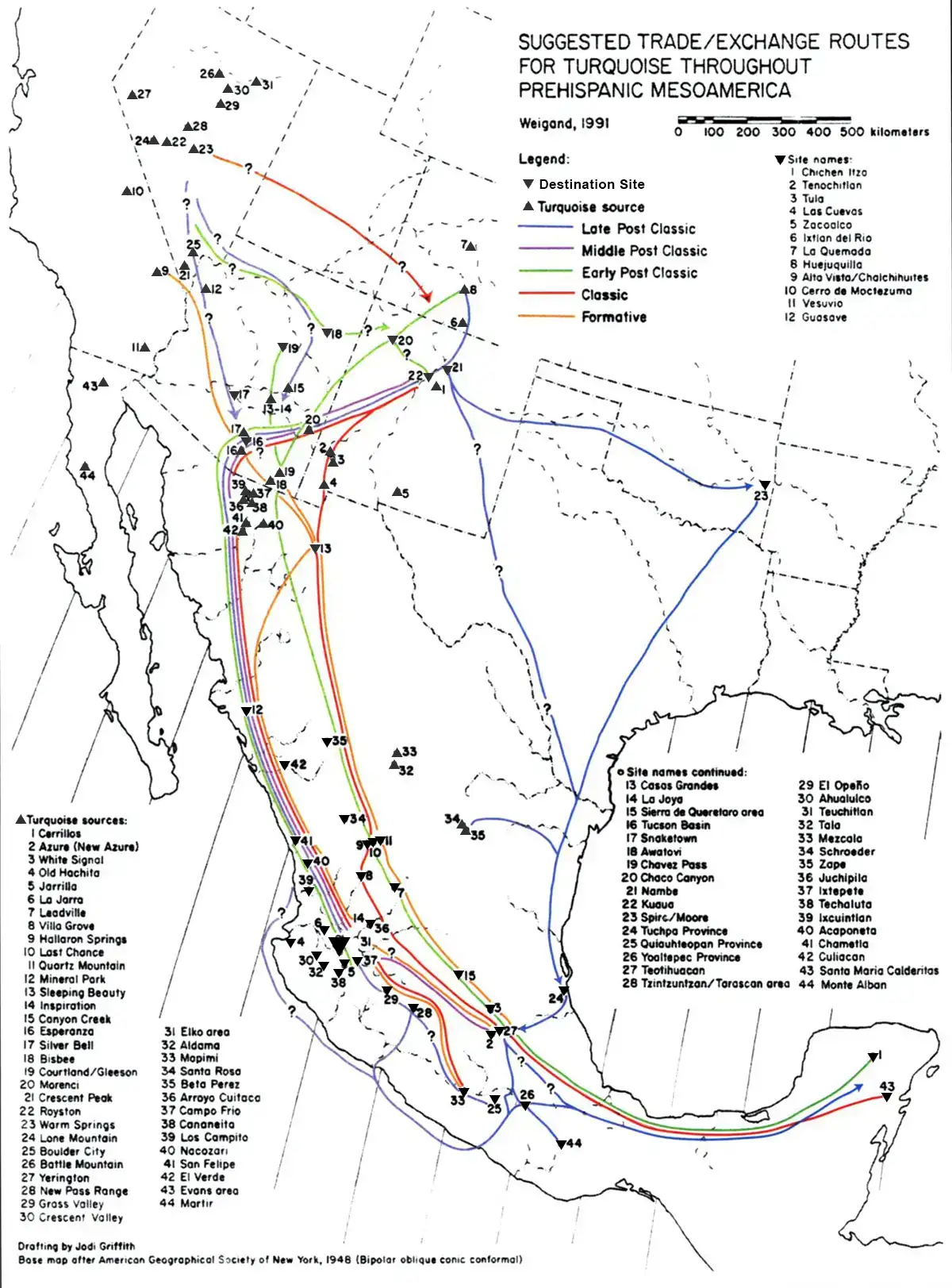
The above map shows sources of turquoise and possible routes of the trade in turquoise as it traveled to its final destination. The trade routes are colored to correspond to the time frames in which they were most active.
According to the map, before 1450 CE much of the long-distance turquoise trade passed through Casas Grandes/Paquimé (#13) on its way south. Trade routes from there were connected with Teotihuacan (#27) in central Mexico. Some of that trade also passed through the Tucson Basin (#16) before heading down to the Pacific shore and then south. After the abandonment of Paquimé, virtually all of that trade passed through the Tucson Basin and on to the Chalchihuites region (#5, #6, #30, #31, #32, #38) until everything in Mesoamerica was interrupted by the advent of the Spanish in the early 1500s.
Map prepared by Phil C. Weigand in 1991, from Ancient Cultural Interplay of the American Southwest in the Mexican Northwest
published in the Journal of the Southwest, Vol 50 #2 (Summer 2008)
with minor modifications by Eyesofthepot
published in the Journal of the Southwest, Vol 50 #2 (Summer 2008)
with minor modifications by Eyesofthepot