Main Subjects
Pueblos
Non-Pueblos
Artists
Shapes & Forms
Design Elements
Sites of the Ancestors

Oasisamerica Cultures in 1350 CE
The stories of the Ancestral Puebloans are still told by their descendants in their native tongues. But it wouldn't be understandable to the ancestors because of the passage of time. Languages are living, evolving things. People and their clans migrate. Intermarriage happens. Among the Rio Grande Pueblos, the pueblo a couple miles downstream might speak a very different language, based on where their forefathers might have migrated from so many hundred years ago and who has merged into their society since.
Today, we trace the evolution of the Puebloans through their migrations: pottery styles, decorations, clan symbols, translations from oral histories and archaeological findings. I find the migration stories really interesting, especially how they are usually supported by following the migration of designs on wall murals, pottery and textiles.
The evolution of languages is a bit harder to sort out. The landscape where this story plays out is mostly desert and sharp mountains. It's relatively isolated, even from parts of itself.
An "original" Amerind language has been speculated, going back several thousand years, perhaps to the time of the Clovis culture. Speculation (and some supporting evidence) has said proto-Amerind made its way to the furthest end of Tierra de Fuego and then headed back north again. As the carriers of newer and newer versions of that language traveled north, they carried new ideas, new technologies and new religious stories and symbolism with them. Uto-Aztecan is speculated to have become a divergent branch of Amerind somewhere on the Pacific coast of Mexico and influenced everyone north from there in the 500s CE. There is evidence of regular trade routes being in use from the earliest days of settlement in Chaco Canyon in the 600s to the arrival of the Spanish in 1540.
The first settlers around the Hopi Mesas seem to have come from western Mexico, up through the Sonoran Desert into the Mojave Desert, then up the Colorado River, through the Grand Canyon to the Little Colorado and then upstream to the Hopi Mesas. Along the way, other groups fell away and split off to become the Supai, the Havasupai, the Virgin Anasazi and the Fremont. Others traveled north before reaching the Grand Canyon and formed the early Great Basin tribes (at least one Hopi clan has its roots in the northern Great Basin).
It is felt the Zuni people may have come north from Mexico in those early days, too, but they seem to have gone almost straight to where they are now and have moved or mixed little since. They do have an affinity with the Hopi and share some religious elements.
The language of the Zuni people is considered a complete isolate because researchers can't find a nearby language with referents, even going back several thousand years. Hopi, considered to be of Uto-Aztecan origin, is comprised of a mix of things as it has been influenced by migrations of the various clans over the last couple thousand years. The language of Oraibi is almost unintelligible to the people of Walpi as Walpi has actively absorbed new clans, concepts and words while Oraibi has enforced a strict isolation for several hundred years now.
Tiwa is possibly a descendant of the language spoken among the pueblos that stretched from Taos to Isleta in the mountains east of the Rio Grande. Because of their location against the western edge of the Great Plains, they were profoundly influenced by the people of the Plains tribes. The people of Isleta also say they are descended from migrants moving north from Aztec centers while the people of Taos say they came south, from a village in the bottom of a lake in the San Luis Valley. However it was, their societies show less influence from the Four Corners/Mesa Verde pueblos and more from the Plains nomads. They have clans but no kachinas.
There is evidence of a migration out of the Four Corners area, through Zuni and into the Acoma and Laguna areas in the late 900s and early 1000s CE. Their native language we now call "Western Keres." What we now call "Eastern Keres" likely came with migrants who left the Mesa Verde area in the mid-to-late 1200s and made their way to the Pajarito Plateau and the valley of the Jemez River before coming to the Rio Grande and claiming farmland in the river bottom. There were also migrant pushes (of unknown language) southeast from the Four Corners, past Acoma and into the northern Gila Mountains. They built seperately from previous pueblos in the area and maintained their previous rituals and ceremonies. Over a couple generations the differences softened and some of those communities banded together.
A friend from Acoma told me she could converse relatively easily in her native Western Keres with people from Laguna, Zia and Santo Domingo. But the further people were from Acoma, the more the language diverged and became unintelligible for her. The sounds are all similar, they just don't mean the same. Each group has also absorbed different new words from the newcomers over the years.
Tiwa, Tewa and Towa have been classified as Kiowa-Tanoan, a language group mostly associated with Plains tribes. The Tanoan source might be found in the indigenous people who lived in the Rio Grande Valley prior to 1250 CE, before the arrival of the migrants from the Four Corners. Further research has proposed to include the Kiowa-Tanoan group of languages in the older Uto-Aztecan family.
It seems the original source of Towa was the Fremont people. When they were forced out of Utah by the bad weather a thousand years ago, some went to the Four Corners/Mesa Verde area, then southwest to the Hopi mesas and while others went southeast to the Jemez Mountains. Others may have merged into the Utes and Paiutes coming in from the west but most seem to have gone north to the valleys of the Yellowstone and Clark Rivers in Montana. From there, some decided to go to the Black Hills and claim some land but that failed after a couple generations of war with the Sioux and Cheyenne. In the process they banded with some nearby Apache survivors and together, they became the Kiowa-Apache. They were then pushed south and west to where they rejoined with the main flow of Kiowas, until they came up against the Comanche in the southern Plains. There they fought a war with the Comanches, lost, and then formed an alliance with them against almost everyone else (although the Kiowa have always had a soft spot for the Crows of southern Montana and northern Wyoming). There were originally 3 major bands of Kiowa and 1 of Kiowa-Apache. The Kiowa-Apache seem to have disappeared since then.
All that I've said above is a really simplified telling of a foggy archaeological tale. There are elements of the tale that have been injected but not properly fitted. One thing that struck me in my research was data about the trade routes connecting Cicuyé directly with Paquimé. The remains of scarlet macaws (from southern Mexico) have been found in many pueblos but the remains of white-fronted parrots (which come from south of Sonora) have been found in only three places: Paquimé, Cicuyé and Grasshopper Pueblo on the Mogollon Rim in Arizona. And turquoise mined in the Villa Grove area in the northern San Luis Valley of Colorado has been found in Chichen Itza, in the Yucatan. We haven't yet decided if that was the result of traders moving short distances and handing things on or were long distance traders involved. There is also the possibility that (and some supporting evidence has been found) travel between the far north and the far south was an act of pilgrimage. The Salado culture had a religious focus and some of their materials have been found south of Paquimé. The Jemez have traced their people back to the Four Corners area in the mid 1200s but recent evidence seems to have tied them to the Fremont culture as far back as 200 CE. All the oral histories tell of people moving back and forth across the countryside many times over the centuries. At Walpi they even tell stories recounting the eruption of Sunset Crater around 1060 CE.
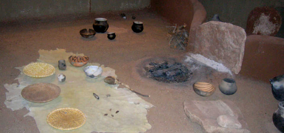
A sample of a floor, wall, firepit and other items found in ancient pithouses
Setting the Stage
So the question on my end is: How far back do I go? In this section of Eyesofthepot, I've so far opted to go back about 2,000 years. If you want to go a bit further back, take a look at Where did Everybody Come From?
There seems to have been two large migration movements into the Four Corners area about 2,000 years ago. One came from the east and north, the other from the south and west. This is where some of my story begins.
Archaeologists excavating Cowboy and Walters caves in southeastern Utah found unfired clay figurines and small, thimble-like objects in strata dated to between 5600 to 5000 BCE. Considering all the other dates I've found in my research, that's probably an outlier where the ceramics somehow got washed into the ancient detritus. The raw clay figurines look very much like images characteristic of the Barrier Canyon rock art style of the northern Colorado Plateau (and the Fremont people). That indicates a possible ritual and symbolic connection between early clay artifacts and rock art. Further to the south that was suggested by early incised pottery and ceramic figurines.
The folks who came from the east and north were of the Shoshonean branch of the human DNA tree and they first settled in the forests and mountains east of Mesa Verde between 1,500 and 2,000 years ago. For the most part, they abandoned the area a thousand years ago and migrated north and northwest.
Some of the folks who came from the south started coming north about 3,000 years ago from central and western Mexico. The earliest ceramic figures found in the desert Southwest were found near Tucson and dated to 1200-800 BCE. The earliest jar fragments were found in the Santa Cruz River valley and dated to 800-400 BCE. They were very simple, designed more for ritual or ceremonial functions, not for household use. The first real containers found have been dated to around 150 CE. It wasn't until the 500s that potters were producing the full range of domestic, ritual and ceremonial wares that have been found. Early ceramics seem to have reached the Mogollon region around 300 CE and the Ancestral Puebloan region in the 400s. Crude, unfired clay bowls have been recovered from Early and Late Basketmaker (200-700 CE) cave sites along the San Juan River drainage in the Kayenta area of northeastern Arizona and southern Utah.
Global Volcanic Effects
- 1783 CE : Laki in Iceland : lava and ash, caused several years of famine in the Northern Hemisphere, killed 80% of Iceland's livestock and 25% of the people starved to death
- 1600 CE : Huaynaputina in Peru : lava and ash, caused crop failures and famine across the Northern Hemisphere from 1601 into 1603
- 1452/1453 CE : Mystery eruption, possibly Kuwae in Vanuatu : several years of no sun, then flooding, then drought. It blew again in 1458, extending the disruptions
- 1315-1317 CE : Mount Tarawera in New Zealand : erupted ash and lava for 5 years, caused famine in Europe
- 1257 CE : Mount Samalas in Indonesia : lava and ash, triggered the Little Ice Age (may have triggered out-migration from Mesa Verde/Four Corners)
- (1060 CE : Sunset Crater eruption in Arizona : caused out-migration in northeastern Arizona)
- 946-950 CE : Paektu Mountain in China and Korea : global volcanic winter for several years
- 930 CE : Ceboruco in Nayarit, Mexico : ash and lava, afterwards active for 500 years
- 536 CE - Worst year in history to be alive anywhere on the planet
- 535 CE - Unknown source, possibly Krakatoa : ash and lava, no sun for months, then flooding, then drought
Each wave of migrants brought new seeds, new technologies and new ideologies with them. They maintained trade relations with the people down south, sending turquoise as far south as the Yucatan and Guatemala. It was along those trade routes that major evolutions in their societies traveled. Those societal changes seem to have arrived in the north in discrete waves, the more prominent of which can be defined loosely as: Hohokam, Mogollon and Ancestral Puebloan, and they most likely came in compressed increments as migratory events. Each society found different sources of turquoise and traded that with different centers in Mexico. Each society grew a cotton that was first grown in northern Peru. They each grew varieties of maize, squash, melons and beans that came north from central Mexico, also in waves as the seeds improved. The Hohokam built platform mounds, the Mogollon built square and rectangular kivas above ground and the Puebloans built round kivas below ground. They all built multi-story cities using stacked stone and adobe mud. Most of my story here concerns the migrants and trade caravans that went to the lands of the Ancestral Puebloans and camped out. The descendants of many are still there. The Hohokam and Mogollon faded away during the extended bad weather events in the mid 1400s.
Most of the precursors of the Ancestral Puebloans seem to have settled in the area south and east of the Colorado River, what we might now refer to as "Kayenta-Tusayan." There they displaced and/or merged with hunter/gatherer clans that had been in the area for hundreds of years. The indigenous culture was part of the Pueblo-Plateau tradition, a shared cultural complex spanning from the Rio Grande valley to the Mojave Desert. Many of the archaeological sites found in the Grand Gulch and Cedar Mesa areas of southern Utah were left by them. They were the people of the Late Archaic, the Basketmaker and the Pithouse time periods. It wasn't until the mindset that turned pithouses into kivas and built with stone-and-mud stack architecture arrived that the Hohokam, Mogollon and Ancestral Puebloan can be said to have formed.
That was in the latter 500s CE. It was in 536 CE that the sun disappeared globally, for several years. One of the largest volcanic eruptions of the last 2,000 years put so much ash into the sky that global temperatures dropped and there was no summer. There were torrential rains instead. Then everything went dry. Crops failed, people starved and there were major upheavals in organized societies around the world. The New World was no exception. People were on the move, looking for a place where they could continue living. In Mesoamerica, many went north, traveling through the mountains and across the deserts, hoping to find better weather and better land with room to grow. In the indigenous oral histories, it is known as the search for the "Middle Place."
The most westerly flow of people seems to have come north through the Sonoran Desert to the Mojave, and then separated into movements north, east and west. North became the Shoshoneans of the Great Basin. West faded into the coast and desert tribes of California. East traveled up the Colorado River, branching into the Virgin Anasazi, the Cohonina, the Sinagua, and possibly the Fremont before emerging from the Grand Canyon as the Kayenta people, then traveling up the valley of the Little Colorado River and reaching the Hopi mesas.
The more central flow of southern people passed across the Sonoran Desert into the Tucson basin and became the early Hohokam. Then they traveled down the Santa Cruz River to the Gila River, to where the Gila met the Salt River, then down to where the Salt opened out into the Valley of the Sun. In the Valley of the Sun the society we call "Hohokam Core" came into its own. Over the next several hundred years they multiplied and spread out, building massive irrigation systems to feed their people. Then the sun disappeared, again, several times. Each time they retracted from their settlement frontiers and reorganized their society. They essentially disappeared in the mid 1400s, their pueblos and valleys completely deserted. The Pima and the Tohono O'odham of southern Arizona may be their direct descendants but they occupy more elevated and more rugged landscapes than the Hohokam did.
The Mogollon appear to have filled the region between the Sea of Cortez, Casas Grandes in the Chihuahuan Desert east of the Sierra Madre, and the Mogollon Rim in New Mexico and Arizona. That gave them the most direct connection to central and southern Mexico. They, too, were a distinct group of cultures spread across a large swath of countryside that essentially disappeared about the same time the weather went really bad in the mid 1400s.
The ideology that became the Ancestral Puebloans passed across Mogollon territory and extended to the north and northwest from there. They stayed east of the Virgin River and south of the Colorado River but they got close to both (the Fremont culture was being birthed on the other side of those rivers). Many of them settled in the Four Corners area while others preferred to live along the Little Colorado River and its tributaries. Some liked living around the mesas in between. Over the next several hundred years the people moved around on the land, building and rebuilding stone villages as they went. Being more northerly, their countryside tended to be cooler and drier so minor variations in the weather had more effect on them. The disappearance of the sun, to a society that absolutely needed and worshiped the sun, was a disaster. Several years with no sun (indicating a complete failure of their religious practices), beginning around 1257 CE, and then a major drought, is what most likely caused the abandonment of the Mesa Verde/Four Corners area. But some folks had already long been leaving the area.
Some of the migrants from the far south went to the area east of the San Francisco Peaks around 600 CE. They built homes and raised crops for several hundred years, then left around 1060 CE when Sunset Crater erupted. Many of them went south to Sinagua pueblos just above and below the Mogollon Rim for the next few decades (Tuzigoot, Montezuma Castle and Well, Walnut Canyon and others). Then they returned and rebuilt the pueblos at Wupatki and Wukoki and took advantage of the renewed soil. Ancient potsherds found around these publos indicate that their residents were in regular contact with the Hopi mesas.
Beginning in 1257 CE, the sun again disappeared behind the clouds for several years. The weather got colder, it rained and snowed a lot more and their crops failed. Then it got really dry from about 1276 to about 1299. However, the entire region was being abandoned in waves before the Great Drought even got started. Archaeologists have been able to follow the trails of two migrations of Kayenta potters and traders as they went south, first into the Tonto Basin, then to the Safford area and then the Upper San Pedro River area and Paquimé. Some went as far as the Pacific coast of central Mexico. There is evidence of a trade in turquoise headed south and macaws, seashells, copper bells and religious symbols headed north (ancient MesoAmerican missionaries or maybe traders hawking the "newest High Society fashions"?). The migrations seem to have ended around 1450 CE, coinciding with the abandonment of Paquimé and Casas Grandes. After about 1450 there were no distinct Hohokam or Mogollon societies left. That made travel and trade across Mexico's northern deserts problematic.
The sun disappeared again in 1536. Again, the weather turned cooler and torrential rains came down for several years. Crops were washed away, people starved, and then it got dry for a few years. It was around that time when most of the descendants of the migrants from the Four Corners area finally settled into the places where they are now (the valleys of the Jemez River and the Rio Grande). There has been movement among and around those settlements since but that's when most of today's centers of population came into being: when the Spanish arrived a few years later they essentially froze the Puebloans in place.
Dates of construction work in various ancient pueblos
Canyon de Chelly
Canyon de Chelly
- White House - 1096-1280
- Canyon del Muerto - ended 1280
- Una Vida - ended 1048
- Casa Chiquita - ended 1060
- Pueblo Pintado - ended 1061
- Hungo Pavi - ended 1077
- Peñasco Blanco - ended 1088
- Kin Ya'a - ended 1106
- Tzin Kletzin - ended 1111
- Pueblo del Arroyo - ended 1117
- Chetro Ketl - ended 1119
- Kin Kletso - ended 1124
- Kinbiniola - ended 1124
- Pueblo Bonito - 800 - 1130
- First building - late 1000s-1120
- Reoccupation - 1225-1275
- Far View House - ended 1078
- Oak Tree House - 1055-1184
- Pipe Shrine House - ended 1214+
- Hemenway House - 1110-1184
- Square Tower House - 1066-1259
- Mug House - 1032-1262
- Spring House - ended 1273
- Cliff Palace - 1073-1273
- Spruce Tree House - 1020-1274
- Balcony House - ended 1279
- Long House - 1024-1280
- Betatakin - ended 1276
- Keet Seel - ended 1284
- Twin Caves - ended 1289
It was around the time of the out-migration from the Four Corners to the Northern Rio Grande that the Kachina, Warrior and Sacred Clown societies seem to have emerged. The changeover in religious symbolism was relatively fast as rock art throughout the area seems to have changed dramatically in a single generation. The previous Pueblo-Plateau tradition was a form of rock art found from the Rio Grande across the Southwest to the Mojave Desert. The new, Rio Grande style, was used to place villages and societies on the surface of the planet. The designs were more complex and were imbued with spiritual powers, personalities and functions to perform. They were indicative of the cosmological overview of the pueblo central to their geographical distribution. Similarly to the Diné and the four Sacred Mountains defining the bounds of their ancestral homeland (even though the Diné are relative newcomers), each pueblo is situated within a similar framework of hilltops, rock outcroppings and hidden alcoves given agency by generations of spiritual leaders of the pueblo. In the old days, that was a way for them to establish and advertise their presence and stake new claims to the land. In most cases (among the Tewa anyway), one or more of the Sacred Mountains is shared with one or more central villages. For instance, the crater at Valle Grande is the western Sacred Mountain for all Northern Tewa pueblos: it is easily seen from all of them. Likewise, Sandia Mountain is their common southern Sacred Mountain. Their eastern and northern Sacred Mountains vary some but are sometimes shared with their immediate neighbors.
Before and during this time period, there were indigenous Tanoan people living throughout the Rio Grande valley but the region was a bit of a backwater and new ideas and technologies arrived later. Things started to change when a trickle of migrants began arriving in the 1000s. When that trickle turned into a flood in the 1200s, the local societies were severely impacted. New clans, new languages, new politics and new technologies arrived in bits and pieces with families, small bands of individuals and groups of ritual specialists (Note: ritual specialists are the leaders at the heart of every clan). The Puebloan languages we see spoken today really began diverging at that point as some of the disparate peoples in each pueblo melted together and merged, taking on characteristics of each, while others were turned away and forced to settle elsewhere, more than likely on more marginal land.
The people already living in the northern Rio Grande area felt the effects of the same drought as the Four Corners region but it most likely wasn't any drought that caused them to move their populations into better agricultural and more defensive positions. They also increased their ability to store food for longer periods of time and each family had become more solely responsible for taking care of their own, even in a pueblo setting. The pueblos built in the Tsegi Canyons (northern Arizona east of the Grand Canyon) in the 1200s had more storage room than living space. It wasn't enough: when the sun disappeared and their crops failed, the pressure on them to move became unbearable and they migrated away to the south.
There were so many people on the move south and east that each pueblo accepted newcomers to a point, then there was pushback. Societies were forced to evolve almost overnight in order to accommodate all the people in movement. Previously, the people of a pueblo only ate together during times of religious ceremony. Suddenly, feasting as a group was promoted everywhere. It was possibly a means of newcomers and old-timers alike to meet-and-greet and share with each other. It worked well in some places, not so well in others. Many newcomers were forced to spread out more and they moved onto more marginal lands. In some cases they merged with the indigenous communities over several generations, and in some cases they didn't. By 1350 there were pueblos built and abandoned all through the Jemez Mountains, the Upper San Juan Valley, Gallina and Gobernador Canyons, and the Santa Fe River and Galisteo Creek drainages. There were also pueblos built and abandoned all through the valley of the Rio Chama and on the eastern side of the Sangre de Cristos. There were pueblos down the eastern side of the Manzano Mountains and all down through desert of the Jornada del Muerto. To the west and south were the pueblos of the Jornada Mogollon.
The Tewa and Keres people living on the Pajarito Plateau were forced down into the Rio Grande valley when the sun disappeared again in 1536. The Rio Chama area was abandoned around that time, too, some of those folks moving down to the Rio Grande while others (the Asa people) went west to the Hopi mesas.
Archaeologists determined that 1319 CE was when the southern structure of Pot Creek Pueblo burned and was abandoned. To the northeast of Pot Creek, Taos Pueblo was invaded and expanded shortly after. Picuris was founded about the same time to the southwest of Pot Creek. Others of the group moved further south, perhaps influencing the "Tiguex" pueblos in the Middle Rio Grande. The Tompiro people were building in the Estancia Valley (east of the Manzano Mountains) and the Piro people were living around the Socorro/Magdalena area. Pottery Mound was being built among other pueblos along the banks of the Rio Puerco, to the west of the Rio Grande.
The Next Wave of Newcomers
The first Athabascans in the area migrated down the eastern flanks of the Rocky Mountains to eastern Colorado/western Kansas and Nebraska, where they settled and spread out for several hundred years. Archaeologists have put "phases" on their evolution and the most important ones for my story concern the Diné (Navajos)and the Apaches. For my story, I'll mention the Apishapa culture (1000 CE-1400 CE), the Sopris phase (1000 CE-1250 CE) and the Antelope Creek phase (1200 CE-1450 CE).
The settlements in eastern Colorado and western Kansas and Nebraska are referred to as the Dismal River culture or complex. Dismal River artifacts have been found from the Continental Divide eastward to the Mississippi River Valley. Among those found eastern artifacts are bits and pieces of pottery that were made in the area of Taos Pueblo.
The Diné have said the less-warlike of the Athabascan people headed west over the mountains and settled in to the nearly empty forests of the Four Corners area. They have always known themselves as Diné (the People). Eventually they were named "Navajo" (a pejorative term) by the Spanish. Most of the Athabascans who stayed east of the mountains were slowly pushed south around the southern end of the Puebloan settlements to where they could finally go west and get away from the Comanches on the east. They flowed into the depopulated Mimbres Mogollon areas around the Gila Mountains, then pushed into the depopulated areas in southern and eastern Arizona. They sorted out into certain areas and became known as various tribes of Apaches: Mescalero, Lipan, Chiricahua, San Carlos, White Mountain.
That got easier for the Apaches after the first Spanish expeditions came through and inadvertently spread European diseases that wiped out whole communities and depopulated the countryside of southern New Mexico between 1540 and 1780. The further south the Apache tribes moved, the fewer native people they found to oppose them. By the early 1700s they had occupied a large part of eastern and southern New Mexico and southern and eastern Arizona. By the early 1800s, the Puebloans were almost completely encircled by the Diné and Apache.
The Jicarilla Apache seem to have developed out of the Antelope Creek, Apishapa and Sopris phases of the Dismal River culture. The Apishapa phase is named after settlements found in the valley of the Apishapa River in south-central Colorado. Just over the plateau to the south is the valley of the Purgatoire, where the Purgatoire Complex and Sopris phase were found. It was on the hills around Trinidad Lake that the skeletal remains of an Athabaskan person were found in the company of micaceous pottery from the area of Pot Creek Pueblo. The big deal here is that the closer these settlements got to the location of Pot Creek Pueblo, the more influence the Rio Grande pueblos had on them.
Antelope Creek, on the other hand, was a Plains culture that built their homes with rock and stone slabs, like the Puebloans. They were also more sedentery, settling in to the area around the Alibates Flint Quarries in the Texas panhandle to raise corn, squash and beans, and chip flint into arrowheads, knives, axeheads and other sharp tools. As the weather was changing, the great herds of American bison slowly moved southward and were flooding across the area by the early 1200s. Their villages spread out further as there was ample food "on the hoof." Then a couple hundred years later they came up against other, more warlike tribes (the Comanche and the Kiowa) who were moving into the area from the north. That caused them to retreat westward, back toward their brothers in the northern mountains of New Mexico.
I say all three of these developmental phases had impact on the early Athabascans as there developed Plains Jicarilla and Mountain Jicarilla branches of the tribe. The Mountain Jicarillas occupied relatively depopulated areas around Pot Creek Pueblo, the Tusas Mountains and the upper Rio Chama valley. The Plains Jicarillas lived east of the Sangre de Cristo Mountains and downstream through the drainage of the Canadian River. Both groups regularly got together for trade with Taos, Picuris and Cicuyé.
At first, the major trade fairs were at Pot Creek Pueblo and that pueblo became perhaps the largest pueblo ever built in the American Southwest. Then a schism developed and at least part of the pueblo burned. That led to abandonment of the village and the founding of Taos Pueblo to the northeast and Picuris Pueblo to the southwest. When Coronado first came to New Mexico, he spent the winter of 1540-41 warring on and stealing food from 12 or 13 "Tiguex" pueblos in the Middle Rio Grande area. When Don Juan de Oñaté came back in 1598 he found only the Tiguex pueblos at Alameda and Isleta still inhabited, the rest having been decimated by European diseases.
The people who would sort out into the Jicarilla Apaches were those who lived outside the main settlements in the Taos-Picuris area. Their society was a bit more nomadic, a bit more hunter-gatherer, until the Spanish tried to force them to settle in one place in the 1700s.
The term Xicharilla was first used by the Spanish to refer to them around 1694. Their warriors were acknowledged to be in the forefront of the Pueblo Revolt of 1680 and that brought them special attention from the Spanish. They occupied the hills and valleys around Taos and Picuris, some even on the eastern slopes of the Sangre de Cristos in the Cimarron River drainage. The Spanish slowly forced them to settle until finally, there was an enclave of Jicarillas at Taos from about 1730 to about 1880. Where they had previously been a loose knit society of families and clans, they began to form a formal tribe with a governmental structure. In the 1880s they were finally granted a reservation of their own by the US Government and the tribal offices moved there. From their earliest days, the Jicarilla people have been known for their micaceous pottery.
The Picosa Culture
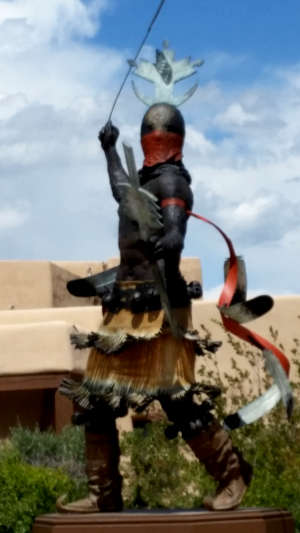
Bronze warrior in front of the
Museum of Indian Arts and Culture
Santa Fe, NM
The "Picosa Culture" is an encapsulation of three separate instances of similar lifestyles, housing and burial practices spread across the Southwestern states and northern Mexico. These three instances: Pinto Basin (Pi), Cochise Tradition (co), and San Pedro (sa), make up the word "Picosa."
Pinto Basin seems to be incorporated within the boundaries of Joshua Tree National Park in southern California. If that's the correct Pinto Basin, that would indicate the model includes projectile points found at a Pinto Culture site in the central Mojave Desert dated to be between 4,000 and 8,000 years old. The older the actual time frame, the wetter the local climate. Artifacts found indicate that these were most likely from a Paiute offshoot of Shoshonean ancestry, possibly precursors of today's Chemehuevi and Mohave people.
The Cochise Tradition is tied to the area of now-dry Lake Cochise, in the Willcox Playa of southern Arizona. The Tradition lasted from about 7,000 years ago to about 2,200 years ago. Archaeologists have broken the Tradition further into three phases, based on discernable changes in projectile point and food processing technology: the Sulphur Spring (7,000 to 5,500 years ago), the Chiricahua (5,500 to 3,500 years ago) and the San Pedro (3,500 to 2,200 years ago).
The San Pedro area is in the San Pedro River basin of southern Arizona. Indications are that the first settlers in the area were infused with migrants headed north from central and/or southern Mexico. This is the area where ceramics first appeared in western North America.
The following sequence of events, first proposed by archaeologist Cynthia Irwin-Williams, defines no fewer than six phases of occupation of Ancient Puebloan sites in the Four Corners area, each identified by projectile point forms and other less well defined artifacts. These, more northern incarnations of the Picosa culture, are encapsulated in the Oshara Tradition.
The Oshara Tradition
- Jay phase : 7,450 to 6,750 years ago - Artifacts found indicate a hunter-gatherer society, distinguished from earlier Paleo-Indians. The evidence suggests that families concentrated on the hunting and gathering of locally available game and food. Over time they learned this was most easily done by living near the heads of canyons. Artifacts found include crude stone tools for processing food and long, narrow projectile points for hunting.
- Bajada phase : 6,750 to 5,150 years ago - An evolution from the Jay phase distinguished by the presence of different projectile points, different cooking hearths, the evolution of ovens and more sites indicating a larger population.
- San Jose phase : 6,750 to 3,750 years ago - The appearance of metates and manos to process grains into food. The size and number of ancestral sites continued to increase. Trash heaps dated to this phase were also found, indicating a level of social organization in the villages.
- Armijo phase : 3,750 to 2,750 years ago - The cultivation of maize began. In good years, that allowed for food surpluses. Seasonal sites, for gatherings of up to 50 people, evolved, possibly due to an increased carrying capacity of the soil to grow and store surpluses of cultivated maize. Projectile points evolved to be different from the concave, short projectile points used by other cultures of the northern Colorado Plateau during the Middle Archaic period. Late in the phase the stone projectile points evolved further, becoming serrated, stemmed blades.
- En Medio phase : 2,750 to 1,550 years ago - Population continued to grow but was locating villages generally at the base of cliffs. The phase was also marked by the introduction of storage pits for surplus food. The time was roughly analogous to the southwestern Basketmaker culture.
- Trujillo phase : starting about 1,550 years ago - Pottery was first introduced during this period.
The Traditional Ancestral Puebloan Timeline

The Ancestral Puebloan Region
1300 CE
- Archaic/Early Basketmaker Era : 9,000 to 3,500 years ago - This is the big gap, after the Clovis people disappeared and before any larger local societies came together. That said, there were people engaged in building monumental architecture and massive irrigation systems in the desert near the Pacific shore of northwestern Peru. They were contemporaries and equals of the ancient pyramid builders then working all over the world in the valleys of the Nile, the Tigris and Euphrates, the Indus and Ganges, the Yellow River... Some of their religious thought and iconography seem to have made their way to the Four Corners area and garnered a lot of converts in the last 30 years of the 1200s.
- Early Basketmaker II Era : 3,500 to 2,000 years ago - The beginnings of the roughest pithouses. The proto-Hohokam are building their first crude irrigation works but most people in the southwest are simply hunter-gatherer nomads migrating back and forth across the countryside with the seasons and the wildlife. Rough ceramics first appear, made of streambed clay.
- Late Basketmaker II Era : 2000 to 1500 years ago - Pithouse technology spread across the southwest as new strains of maize and squash, then beans, appeared, most likely carried north from central Mexico by immigrants from that area. The new maize had larger kernels and offered a much better food source, if only decent soil and regular water were available and if the folks took the time to protect it a bit while it grew. Consuming maize and beans together provided a more complete protein source, which allowed for greater population expansion.
- Basketmaker III Era : 500 to 750 CE - 536 CE is said to have possibly been the worst year in history to be alive, as a massive volcanic eruption on the other side of the planet had plunged most of the world into a volcanic winter in late 535. This may have been the series of extended bad weather events that caused another push of ancient ancestors to leave their homes in south and central Mexico and travel north. The distinct Hohokam, Mogollon and Ancestral Puebloan cultures didn't come into full expression until around 600 CE. There probably wasn't much difference between any of those groups until much later, after each had occupied their own countryside for several generations and adapted their technologies and world views to fit.
The first decorated pottery began to emerge as tribes and families settled down more and grew more maize, squash and beans. The first above-ground structures appeared and some pithouses were converted into the first kivas. The people began to gather together in villages and develop into societies. - Pueblo I : 750 to 900 CE - Pueblo buildings were constructed of stone with south-facing windows, and in U, E and L shapes. The buildings were located closer to each other, reflecting the deepening of merged religious celebrations. Some kivas had towers built nearby, towers most likely used for look-outs. Pottery became used for more than just cooking, and included pitchers, ladles, bowls, jars and dishware for food and drink. White pottery with black designs first emerged in this time period, the pigments being developed from plant sources. Water conservation techniques and complex irrigation systems using reservoirs and silt-retaining dams also emerged during this period.
- Pueblo II : 900-1150 CE - During the Pueblo II period the population increased so much that more than 10,000 sites were created in 150 years. Since most of the countryside was arid, the people supplemented their diet by foraging, hunting and trading pottery for food. By the end of the Pueblo II period, there were many two-story dwellings made almost exclusively of stone masonry, the presence of towers and the development of family and community kivas. This was the Classical Period for the Mimbres Mogollon and the Chaco Culture. The Mimbres Culture seems to have virtually collapsed around 1150 due to changing weather conditions. The elites at Chaco had already sent engineers and crews north to build a new capital near the Animas River, where today's Aztec Ruins National Monument is. By 1150, Chaco Canyon was essentially deserted, the people having moved north to Aztec and to reoccupy Mesa Verde. However, in the mid 1100s came global catastrophe: another series of massive volcanic eruptions that poured huge amounts of sulphurous gases and ash clouds into the atmosphere. Again the sun disappeared for months, being only a slightly brighter spot in a sky of dark gray. And the rains were torrential and came often.
- Pueblo III : 1150-1350 CE - There was a significant community change during the Pueblo III period. This was the time of the height of Mesa Verde and its progressively more defensible constructions. It was also the time of the founding of Pottery Mound in central New Mexico and many now-abandoned pueblos around the Hopi mesas and in the White Mountains. Much of the population moved from dispersed farmsteads to defensible community centers at canyon heads, then to more defensible cliff dwellings on canyon shelves. Population peaked between 1200 to 1250 at more than 20,000 in the Mesa Verde region alone, far more than could be sustained for any length of time. By 1280 the Ancestral Puebloan people had abandoned most of their settlements as a result of climate changes, food shortages, dwindling resources and incoming warlike tribes (Apache, Dineh and Ute). Many of them migrated to villages in northern Arizona and northwestern New Mexico. Many in New Mexico spent 50 or more years living on the Pajarito Plateau before migrating closer to the Rio Grande river bottom.
The late 1200s and early 1300s was also the time period in which the rock art changed. The previous Pueblo-Plateau tradition is identified by rock art that stretches from southern Nevada across Arizona to east of the Rio Grande. It basically featured small, blocky individuals and miscellaneous geometric designs (spirals, hands, etc.) The new, Rio Grande tradition, featured larger images that were outlined and then filled with geometric designs signifying spiritual depth. Beyond that, there was a cosmology mapped to the countryside surrounding each pueblo in the rock art, giving personality and agency to the rocks, hills and land itself. Kachina faces are a signature feature of the Rio Grande tradition and the proliferation of the kachina traditions has been dated to the migrations of the late 1200s. An interesting note: the languaging of the kachina traditions, for every language and pueblo, is filled with Keresan words. That indicates a single source for a new spiritual awakening emanating to all puebloans, seemingly beginning in the Mesa Verde area in the mid-1200s CE. - Pueblo IV : 1350-1600 - The Pueblo IV time period saw many tribes and familes still migrating toward more stable water sources, and building "disposable" (not meant to be occupied for more than a few years) pueblos along the way. The Towa expanded eastward to Cicuye (beside the Pecos River) and the Southern Tewas and Eastern Keres moved into the Santa Fe and Galisteo River Basins. It was a hard living in the drier Galisteo Basin but potters there developed a multi-colored lead glaze from the turquoise, silver and lead formations found in the Cerrillos Hills. They used that leaded glaze to paint decorations on their pottery. Apparently it was all the rage because trading that pottery sustained them for several generations, until the Spanish arrived and the living conditions became unbearable. Then the Spanish claimed the lead mines for themselves and denied the people access.
Those of Keres origin slowly moved down the Galisteo River and merged into the village at Santo Domingo. Those further north, the Southern Tewas in the Santa Fe River Basin, migrated to Hopi First Mesa where they became the ancestors of today's Hopi-Tewas. The Santa Clara people first built the dwellings at Puye in Santa Clara Canyon on the eastern slopes of the Jemez Mountains around 1200 CE. The structures were completely abandoned around 1600 CE when the Santa Clarans moved further down the hill to where the Santa Clara River meets the Rio Grande. The San Ildefonso people had stopped at what is now "Tsankawi" before continuing down to the Rio Grande. Tsankawi is between Puye in Santa Clara Canyon to the north and Tyuonyi in Frijoles Canyon to the south. Many of the people who became Cochiti, Santo Domingo and San Felipe made a centuries-long stop in Frijoles Canyon before moving on to settle downstream along the Rio Grande, near where they are now. - Pueblo V (1600-present) Pueblo V saw the occupation by the Spanish and a consolidation and reduction of Puebloan tribes and lands. The arrival of the Spanish turned the pueblo world upside down, beginning in earnest in 1598. Conditions under the Spanish were so bad the pueblos banded together and revolted in 1680 and threw the Spanish out. The Spanish came back several times, looting and burning the southern-most pueblos again and again. Finally, the Alamedans (southern Tiwa) packed up and moved to Payupki, a pueblo they built on the northern end of Second Mesa in Hopiland.
The Spanish came back in force in 1692. Their army was composed mostly of prisoners from the dungeons of Chihuahua, ordered to march north with Don Diego de Vargas and never come back on pain of death. With that driving them, the Conquistadors began again under the Catholic Spanish flag, but they began again a little differently. This time around, the missionaries weren't nearly as hard on the people. De Vargas, though, was intent on punishing the people for every perceived tiny infraction of Spanish law. There was significant pushback from the people and the Spanish kept attacking, looting and burning their villages, only to see them be rebuilt more defensively a short time later. The Jemez pushed back so hard the Spanish finally just forced them out of the mountains and into one village on the Jemez River, Walatowa, where most Jemez (and the descendants of Cicuyé/Pecos) are today. It is estimated that between 1598 and 1740, the number of Towa-speakers in the Jemez Mountains dropped from about 5,000 to about 140.
Upper right maps courtesy of Wikipedia userid Yuchitown, CCA-by-SA 4.0 License
Middle right maps courtesy of Archaeology Southwest
Photos courtesy of Eyesofthepot, CCA-by-SA 4.0 License
Middle right maps courtesy of Archaeology Southwest
Photos courtesy of Eyesofthepot, CCA-by-SA 4.0 License
Sites of the Ancients and approximate dates of occupation:
Ancestors Index
Atsinna : 1275-1350
Awat'ovi : 1200-1701
Aztec : 1100-1275
Bandelier : 1200-1500
Betatakin : 1275-1300
Casa Malpais : 1260-1420
Chaco Canyon : 850-1145
Atsinna : 1275-1350
Awat'ovi : 1200-1701
Aztec : 1100-1275
Bandelier : 1200-1500
Betatakin : 1275-1300
Casa Malpais : 1260-1420
Chaco Canyon : 850-1145
Cicuyé : 800-1838
Fourmile Ranch : 1276-1450
Giusewa : 1560-1680
Hawikuh : 1400-1680
Homol'ovi : 1100-1400
Hovenweep : 50-1350
Jeddito : 800-1700
Kawaika'a : 1375-1580
Fourmile Ranch : 1276-1450
Giusewa : 1560-1680
Hawikuh : 1400-1680
Homol'ovi : 1100-1400
Hovenweep : 50-1350
Jeddito : 800-1700
Kawaika'a : 1375-1580
Keet Seel : 1250-1300
Kuaua : 325-1580
Mesa Verde : 600-1275
Montezuma Castle : 1200-1400
Payupki : 1680-1745
Poshuouingeh : 1375-1500
Pottery Mound : 1320-1550
Puyé : 1200-1580
Kuaua : 325-1580
Mesa Verde : 600-1275
Montezuma Castle : 1200-1400
Payupki : 1680-1745
Poshuouingeh : 1375-1500
Pottery Mound : 1320-1550
Puyé : 1200-1580
Sikyátki : 1375-1625
Snaketown : 300 BCE-1050
Tonto Basin : 700-1450
Tuzigoot : 1125-1400
Wupatki/Wukoki : 500-1225
Wupatupqa : 1100-1250
Yucca House : 1100-1275
Snaketown : 300 BCE-1050
Tonto Basin : 700-1450
Tuzigoot : 1125-1400
Wupatki/Wukoki : 500-1225
Wupatupqa : 1100-1250
Yucca House : 1100-1275