Main Subjects
Pueblos
Non-Pueblos
Artists
Shapes & Forms
Design Elements
Homol'ovi
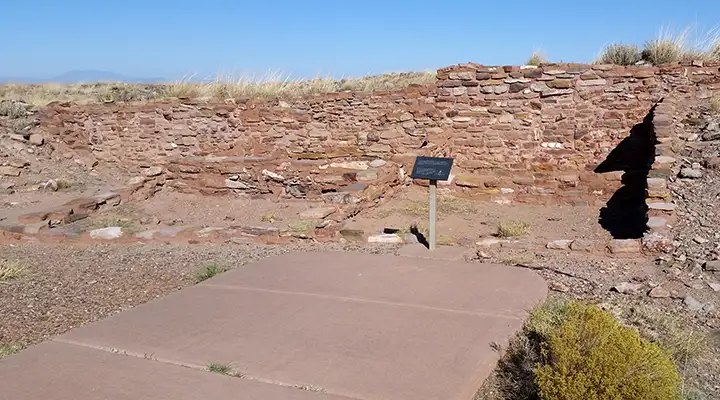
Reconstructed walls at Homol'ovi 1
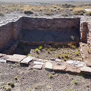
Reconstructed kiva walls
The Hopi spelling is "Homol'ovi." There are four separate settlements here, all within a few miles of each other along the floodplain of the Little Colorado River northeast of what is now Winslow, Arizona. The floodplain at Homol'ovi I was about 4 miles wide. With a bit of irrigation the location would have been excellent for growing maize, squash and beans, the staple foods of their diet back then. The river valley was also lush enough to support a good population of wild game.
Archaeologists figure the settlement known as Homol'ovi I was possibly begun by migrants coming from the south, from Hohokam and Mesoamerican sources migrating north and discovering the empty floodplain next to the Little Colorado. Their knowledge of irrigation made living in the area relatively easy for a couple hundred years. During that time their population was boosted by incoming migrants from other local areas.

A polychrome mug from Homol'ovi I
The beginnings of Homol'ovi II, III and IV date to the late 1000s CE, to the migrations out of Sinagua areas to the north, the countryside of Wupatki and Wukoki. That migration was triggered by the eruption of Sunset Crater. A hundred years later some of them returned north.
Then came an influx of people from the Betatakin and Keet Seel and other parts of the Kayenta region as those areas were being abandoned in the late 1200s CE. There was a distinct change in the forms and decorations of pottery at that time.
By the late 1300s, the pueblos of Homol'ovi were all abandoned, most of the people having relocated to the Hopi mesas or upstream on the Little Colorado River to the land of the Zuni.
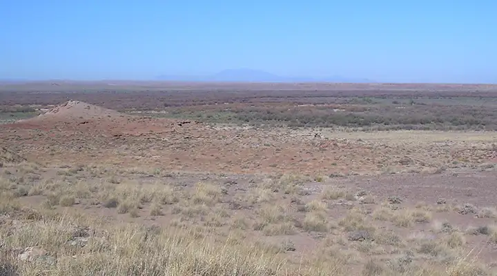
Looking across the Little Colorado River valley toward the San Francisco Peaks
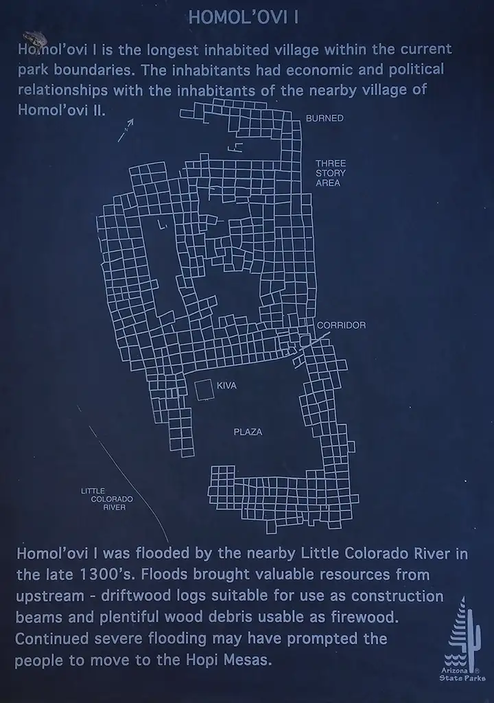
Map of Homol'ovi I
Photos courtesy of EyesofthePot, CCA-ShareAlike 4.0 License
Sites of the Ancients and approximate dates of occupation:
Ancestors Index
Atsinna : 1275-1350
Awat'ovi : 1200-1701
Aztec : 1100-1275
Bandelier : 1200-1500
Betatakin : 1275-1300
Casa Malpais : 1260-1420
Chaco Canyon : 850-1145
Atsinna : 1275-1350
Awat'ovi : 1200-1701
Aztec : 1100-1275
Bandelier : 1200-1500
Betatakin : 1275-1300
Casa Malpais : 1260-1420
Chaco Canyon : 850-1145
Cicuyé : 800-1838
Fourmile Ranch : 1276-1450
Giusewa : 1560-1680
Hawikuh : 1400-1680
Homol'ovi : 1100-1400
Hovenweep : 50-1350
Jeddito : 800-1700
Kawaika'a : 1375-1580
Fourmile Ranch : 1276-1450
Giusewa : 1560-1680
Hawikuh : 1400-1680
Homol'ovi : 1100-1400
Hovenweep : 50-1350
Jeddito : 800-1700
Kawaika'a : 1375-1580
Keet Seel : 1250-1300
Kuaua : 325-1580
Mesa Verde : 600-1275
Montezuma Castle : 1200-1400
Payupki : 1680-1745
Poshuouingeh : 1375-1500
Pottery Mound : 1320-1550
Puyé : 1200-1580
Kuaua : 325-1580
Mesa Verde : 600-1275
Montezuma Castle : 1200-1400
Payupki : 1680-1745
Poshuouingeh : 1375-1500
Pottery Mound : 1320-1550
Puyé : 1200-1580
Sikyátki : 1375-1625
Snaketown : 300 BCE-1050
Tonto Basin : 700-1450
Tuzigoot : 1125-1400
Wupatki/Wukoki : 500-1225
Wupatupqa : 1100-1250
Yucca House : 1100-1275
Snaketown : 300 BCE-1050
Tonto Basin : 700-1450
Tuzigoot : 1125-1400
Wupatki/Wukoki : 500-1225
Wupatupqa : 1100-1250
Yucca House : 1100-1275